 Graphical abstract
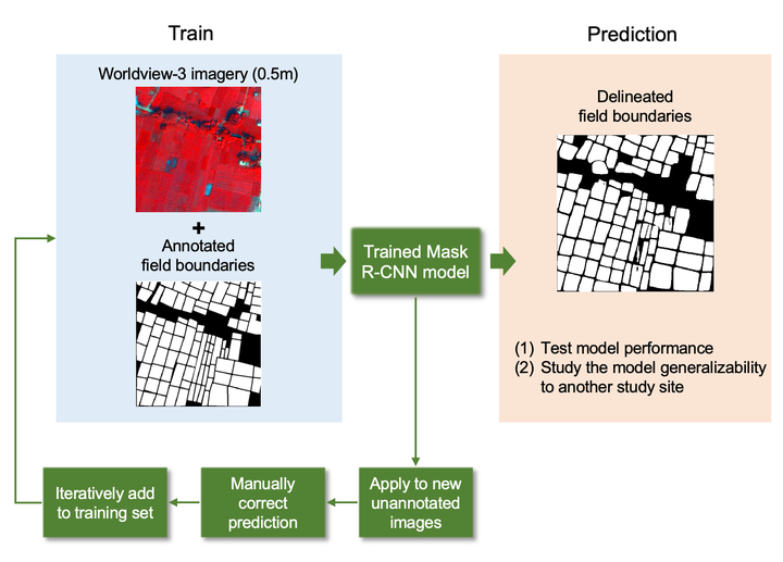
Abstract
The mapping of field boundaries can provide important information for increasing food production and security in agricultural systems across the globe. Remote sensing can provide a viable way to map field boundaries across large geographic extents, yet few studies have used satellite imagery to map boundaries in systems where field sizes are small, heterogeneous, and irregularly shaped. Here we used very-high-resolution WorldView-3 satellite imagery (0.5 m) and a mask region-based convolutional neural network (Mask R-CNN) to delineate smallholder field boundaries in Northeast India. We found that our models had overall moderate accuracy, with average precision values greater than 0.67 and F1 Scores greater than 0.72. We also found that our model performed equally well when applied to another site in India for which no data were used in the calibration step, suggesting that Mask R-CNN may be a generalizable way to map field boundaries at scale. Our results highlight the ability of Mask R-CNN and very-high-resolution imagery to accurately map field boundaries in smallholder systems.
Isabella Hinks
she/her/hers
PhD Candidate, 2020-2024
I am a Ph.D. candidate at the Center for Geospatial Analytics at NC State University.