Does chilling explain the divergent response of spring phenology to urban heat islands?
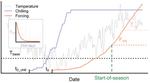
Urbanization is known to have direct impacts on plant phenology. Understanding these effects is important to biodiversity dynamics, ecosystem structure, carbon cycles, and human health. Temperature increases from the Urban Heat Island (UHI) effect are thought to be the main driver of plant phenological changes around cities. However, trends in plants’ start of growing season (SOS) dates around urban areas, compared to the surrounding countryside, have diverged across the globe: some advance, and some delay. Divergent SOS trends have been observed in field measurements as well as satellite remotely sensed terrestrial vegetation seasonality—land surface phenology (LSP). However, the reasons for this phenomenon remain unclear. We hypothesize that divergent SOS trends can be explained by the interaction between UHI-induced seasonal temperature changes and variable plant chilling requirements—the need of plants to be exposed to sufficiently low temperatures to release dormancy in spring. The proposed project is designed to evaluate this hypothesis by accomplishing two main objectives:
• Objective 1: Map long-term medium spatial resolution LSP for large cities.
- More than 50 large cities in North America that are expected to have strong UHI effects will be selected to capture variability in biome type and prevailing climate.
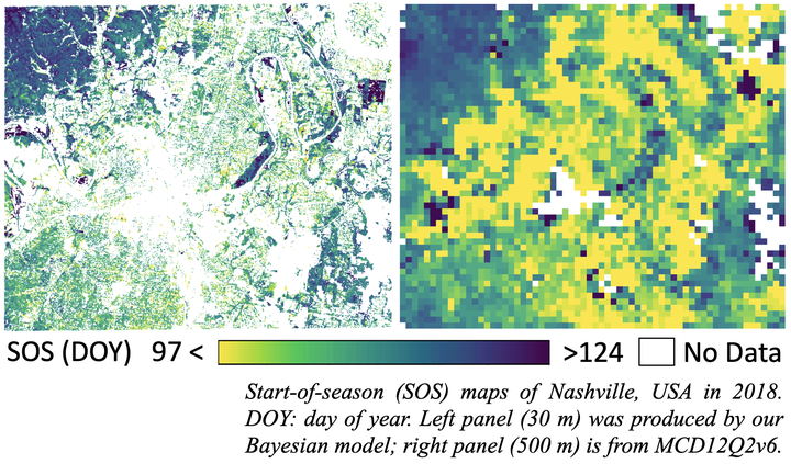
- LSP with pixel-wise uncertainty at 30 m spatial resolution from 1984 to present will be retrieved for each selected city using a recently developed Bayesian model.
• Objective 2: Test chilling hypothesis by analyzing spring phenology models
- A suite of models describing spring emergence as a function of daily temperature exposures will be fit using the generated LSP data.
- Analysis of model fit and parameters will indicate the importance of UHI-altered chilling/warming regimes.
We expect this work will make contributions to the remote sensing, phenology, and global change science communities by providing:
- An improved understanding of how temperature controls plant phenology in urban areas;
- A novel approach to retrieve medium spatial resolution LSP with pixel-wise uncertainty that can be generally applied to urban or natural regions,
- A long-term 30 m spatial resolution LSP dataset for large cities in North America.
Xiaojie Gao
he/him/his
PhD Candidate, 2019-2023
PhD candidate at Center for Geospatial Analytics, North Carolina State University.